CONVENIENCE, CONVENIENCE, CONVENIENCE
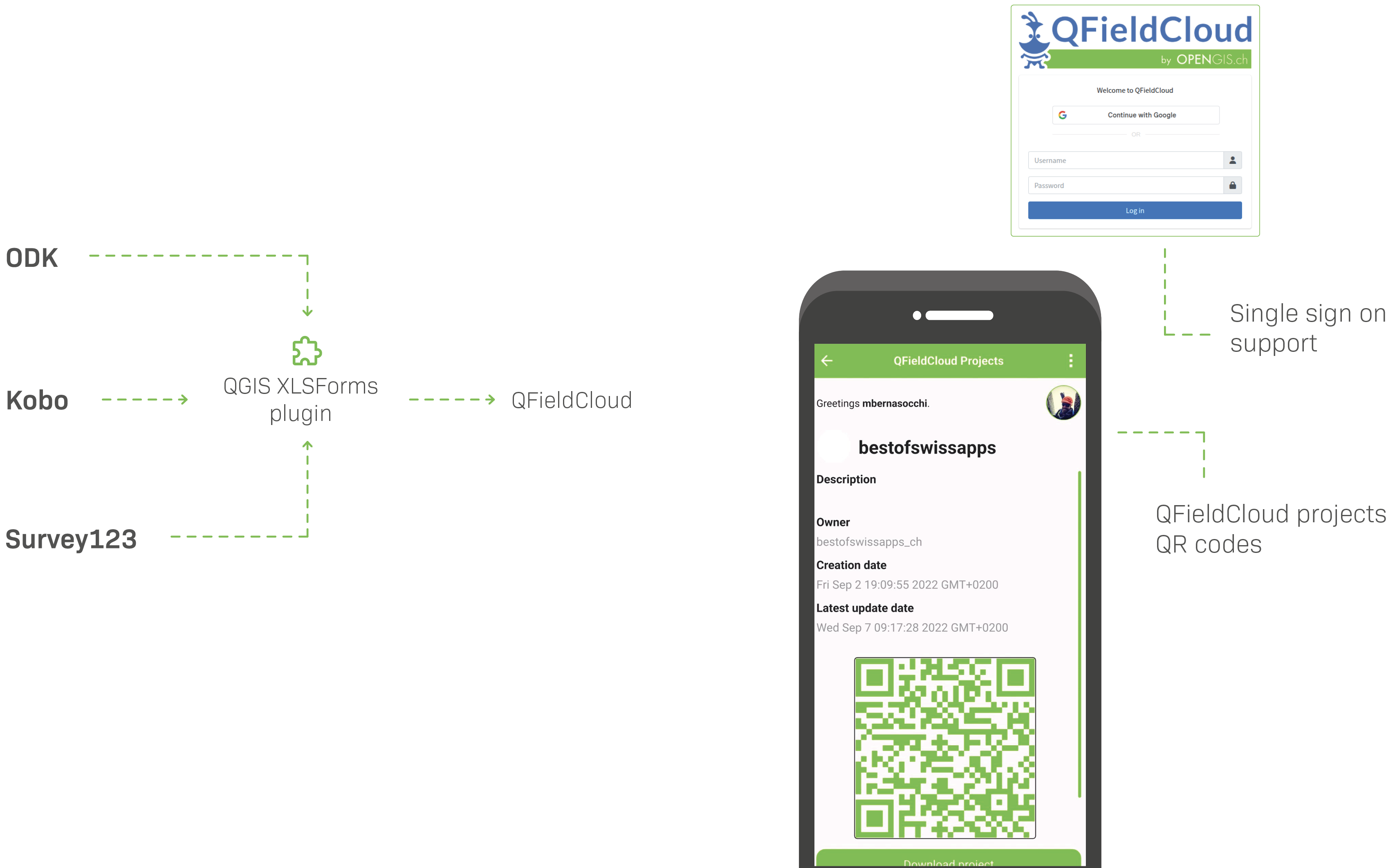
Easily migrate your XLSForms into QField projects with our new QGIS plugin

MADE FOR YOU
Use it, extend it, make it your own.
qfield.org/partner
TONGA
MAFF
– Photo capture as attachments to
referenced geometries
– QFC API / SDK allowed for custom
application integration
– QFC API documentation allowed
for easy writing of a R module to
communicate with QFC server/project
data
SEVENSON
ENVIRONMENTAL SERVICES
– Sponsored sensors framework to fuse spatial location and radition readings data
– On-canvas visual analysis rendered while field workers gather data thanks to QGIS’
powerful data-defined symbology data
– Windows support meant easier migration with preexisting hardware
SEVENSON
ENVIRONMENTAL SERVICES
KULTURRETTER,
DAI
– Workflow to collect and manage data in a seamless
manner for the emergency rescue of cultural heritage
– The German Indiana Jones :) supported quite a few
functionality additions for our camera that includes
geotagging (inc. compass), and details stamping
(i.e. bottom left “date / lat lon / etc”)
kulturgutretter.org
GROUPEMENT FORESTIERS
QUÉBEC
– Sponsored auto pushing of changes
to QFC on a regular interval
– Supported significant improvements
on tracking functionalities, including
project-setup tracks
BIOTOPE
GROUPEMENT FORESTIERS
Terrex Seismic
Made background tracking a reality
through collective funding
NATIONAL LAND SURVEY FINLAND
(NLS)

NLS
— Sponsored processing toolbox
integration to conduct operations such
as rotation, orthogonalization, and affine
transformations
— Supported tons of snapping
improvements, incl. new snapping
to closing segment allowing for
perfect 90 degree buildings while
digitizing (QField 3.5)
NLS
Rely on QField's external GNSS
device support for precise location
SWISS QGIS
USER GROUP
— Sponsored sketching over
photos captured in the field
— Sponsored drawing over
templates
MONGABAY
– Tracking for own safety and to gather
evidence of enviromental destruction
within protected areas
– Free to use, no hidden strings
– Dataset support = low barrier of entry
(i.e. can open a georeferenced PDF)
WASTE
MANAGEMENT
MILANO
- Sponsored plugin framework to customize UX
- Supported near field communication
(NFC)/QR Code
- Rely on powerful feature form configuration
FUTURA
SISTEMI
- Integration with 3rd party WebGIS
management system through QFC API
- Leveraging QField/QFC
offline work capability
NATIONAL WATER
WASTE MANAGEMENT
COSTA RICA
NATIONAL WATER
WASTE MANAGEMENT
COSTA RICA
On-premise QFC
AND MANY
MORE
– DB
– BLS
– SOB
– UN
– …


