QField Plugins
to the rescue
Natural catastrophe rapid mapping in 2024
The floods flow through Zermatt
rapidmapping.ch quickly created nadir imagery
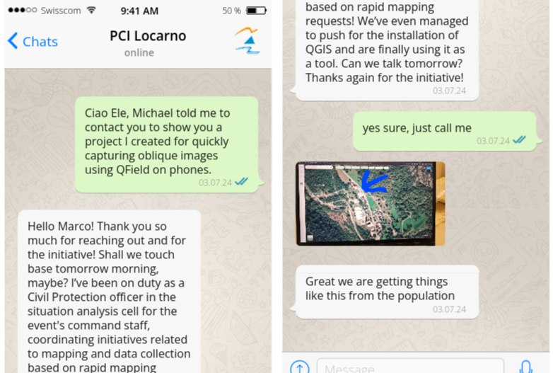
What about ground truth?
What about
plugins?
Learnings
- Complete architecture setup in 2 days (including coding a proxy server and developing the QGIS project), in future couple of hours.
- Allow subscribing to a project directly in QFieldCloud
- Streamlining subscription and onboarding are crucial
- Use setting to avoid downloading of all images when a reporter joins
- Possibly allow reaching images from webgis without a proxy server

Open source Geoninjas
Made in Switzerland
Thanks! Questions?
qfield.org | qfield.cloud
@opengisch