OPEN SOURCE
GEONINJAS
MADE IN
SWITZERLAND
we l[i|o]ve open source.
WHY
QFIELD?
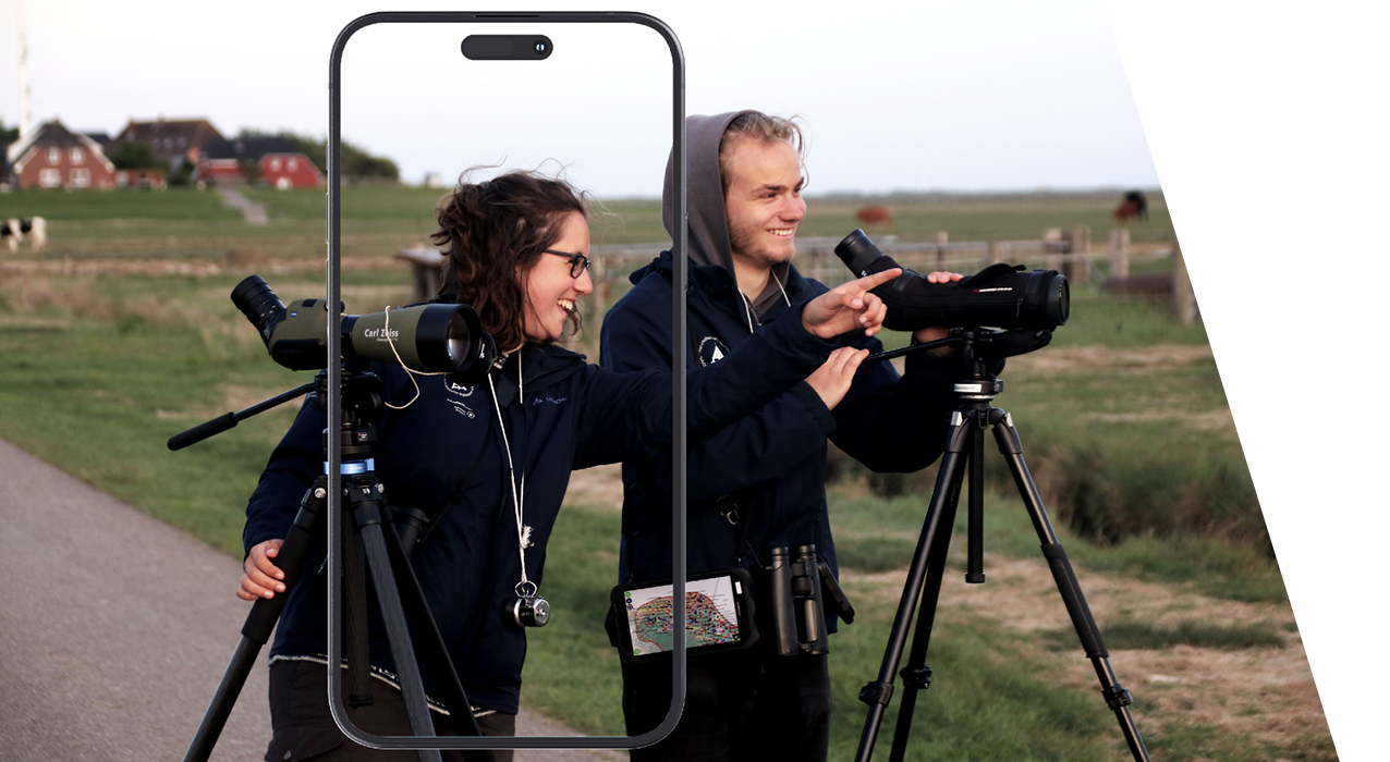
because data is outside the office.
WHAT IS
QFIELD?
WHAT IS QFIELD?
The mobile data collection app for QGIS
WHAT IS QFIELD?
Minimalist User Interface
WHAT IS QFIELD?
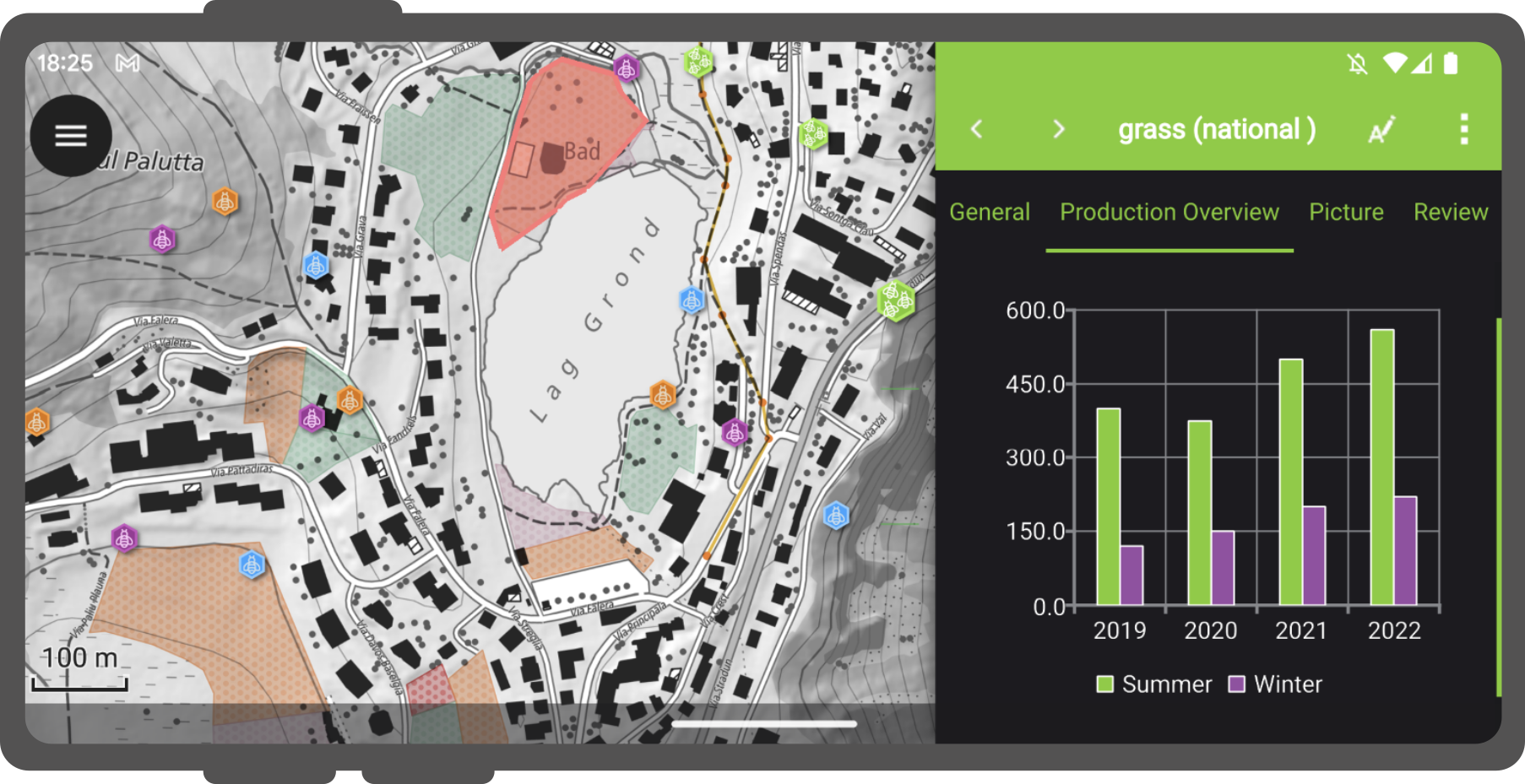
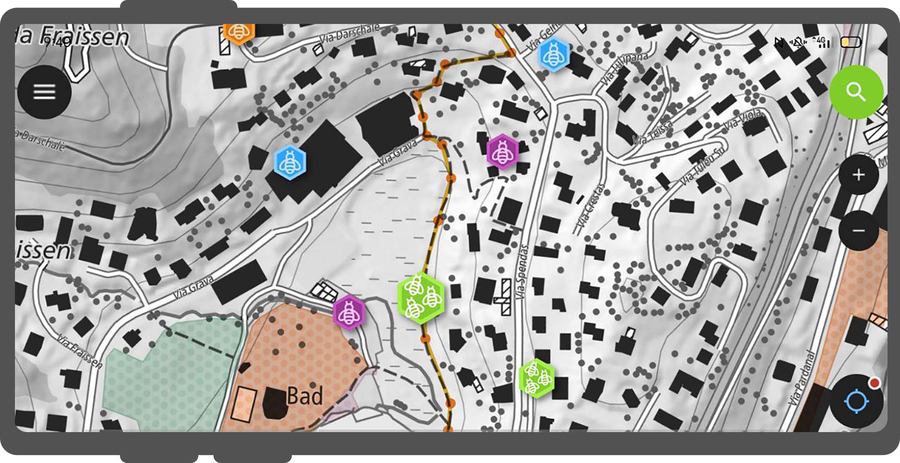
Beautiful cartography

WHAT IS QFIELD?
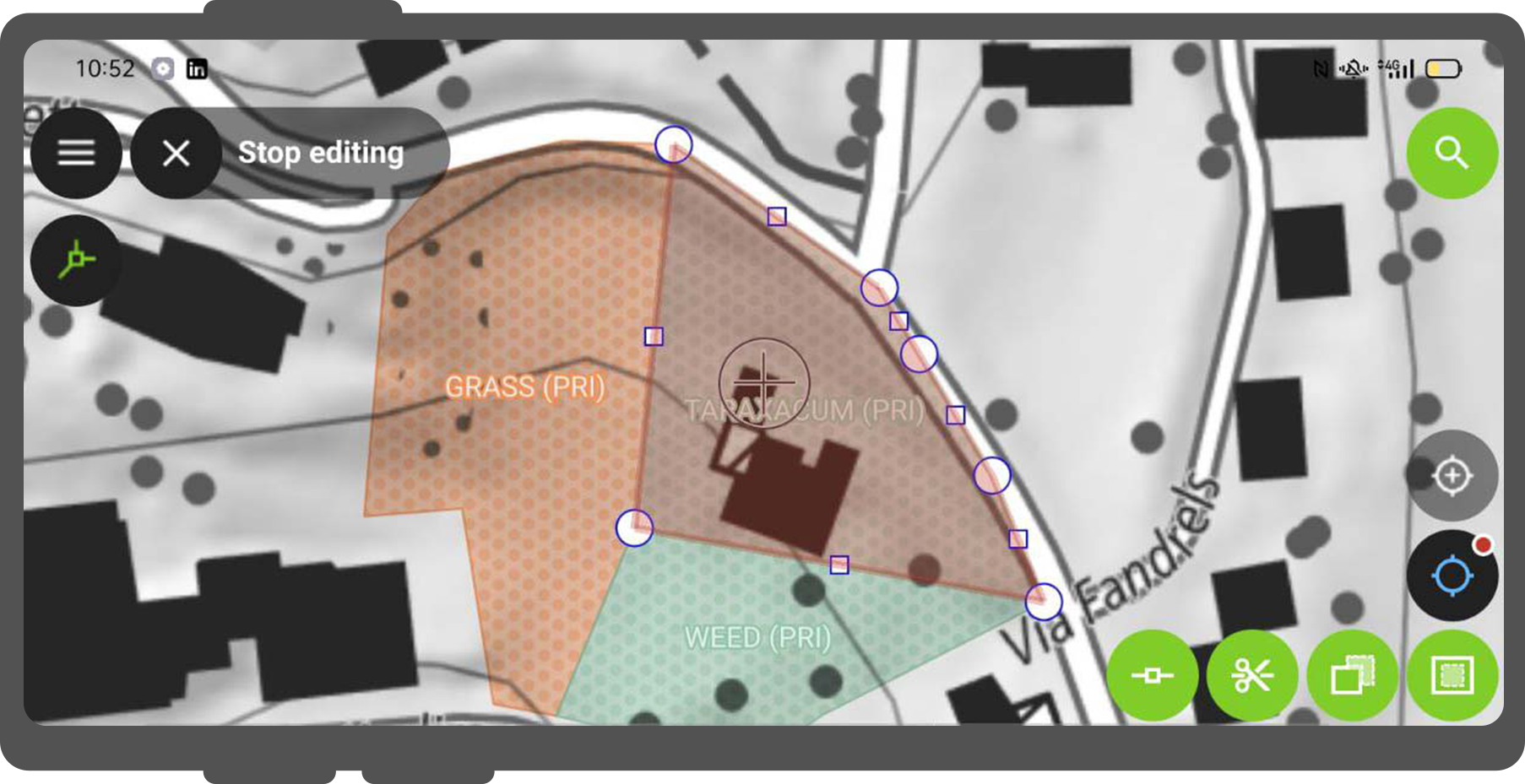
Powerful tools
WHAT IS QFIELD?
Efficient interaction

WHAT IS QFIELD?
Beneficial integrations

WHAT IS QFIELD?
Professional hardware
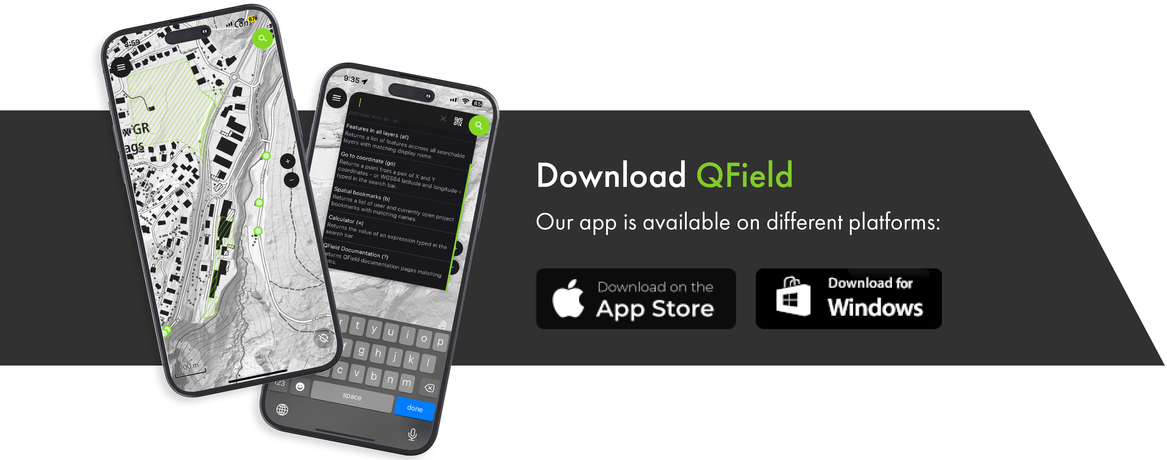
SUPPORTED
PLATFORMS
OUR
HISTORY
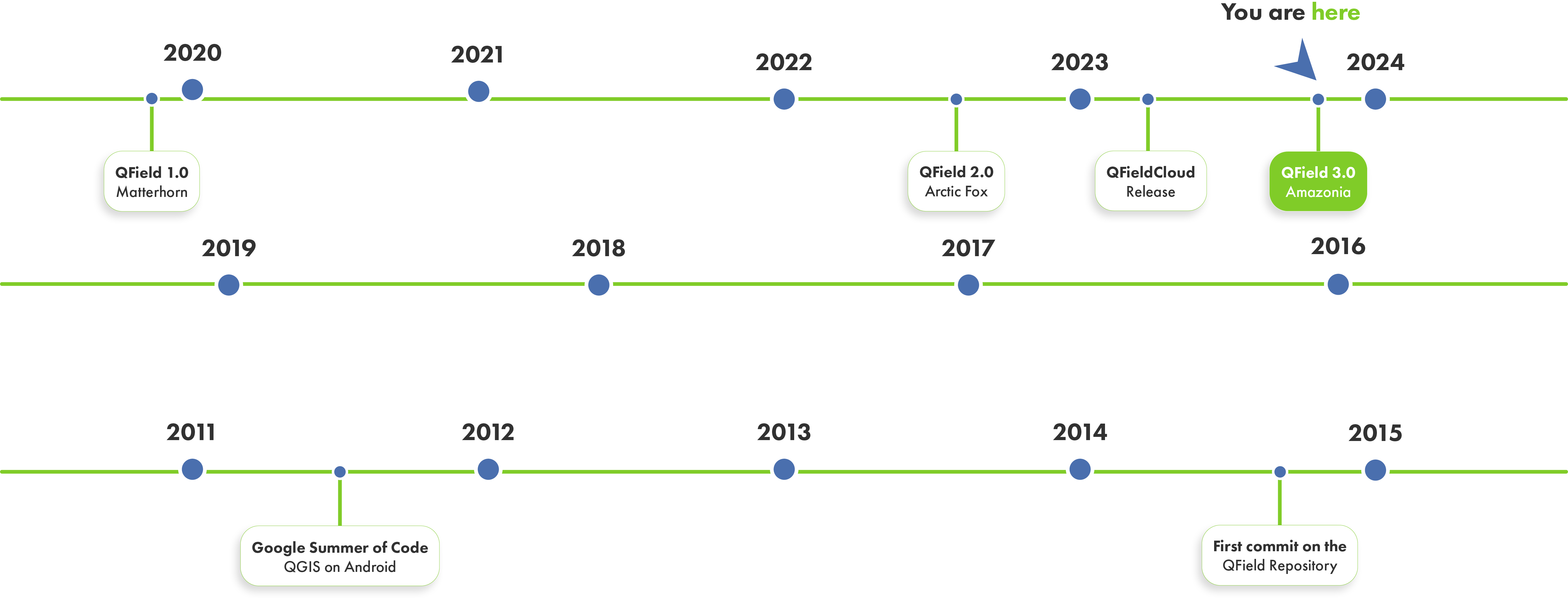
OUR
HISTORY
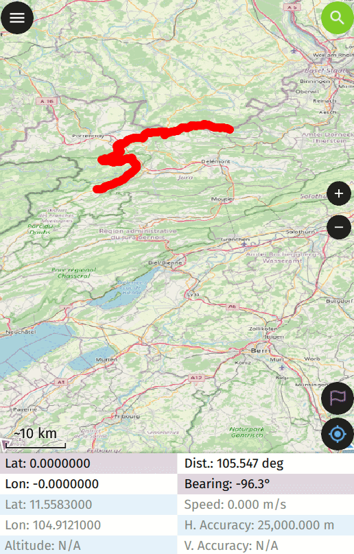
GPS, TRACKING
AND NAVIGATION
GPS, TRACKING AND NAVIGATION
High Precision GNSS Integration
- Bluetooth
- UDP
- TCP
- Serial port (USB)
- Internal
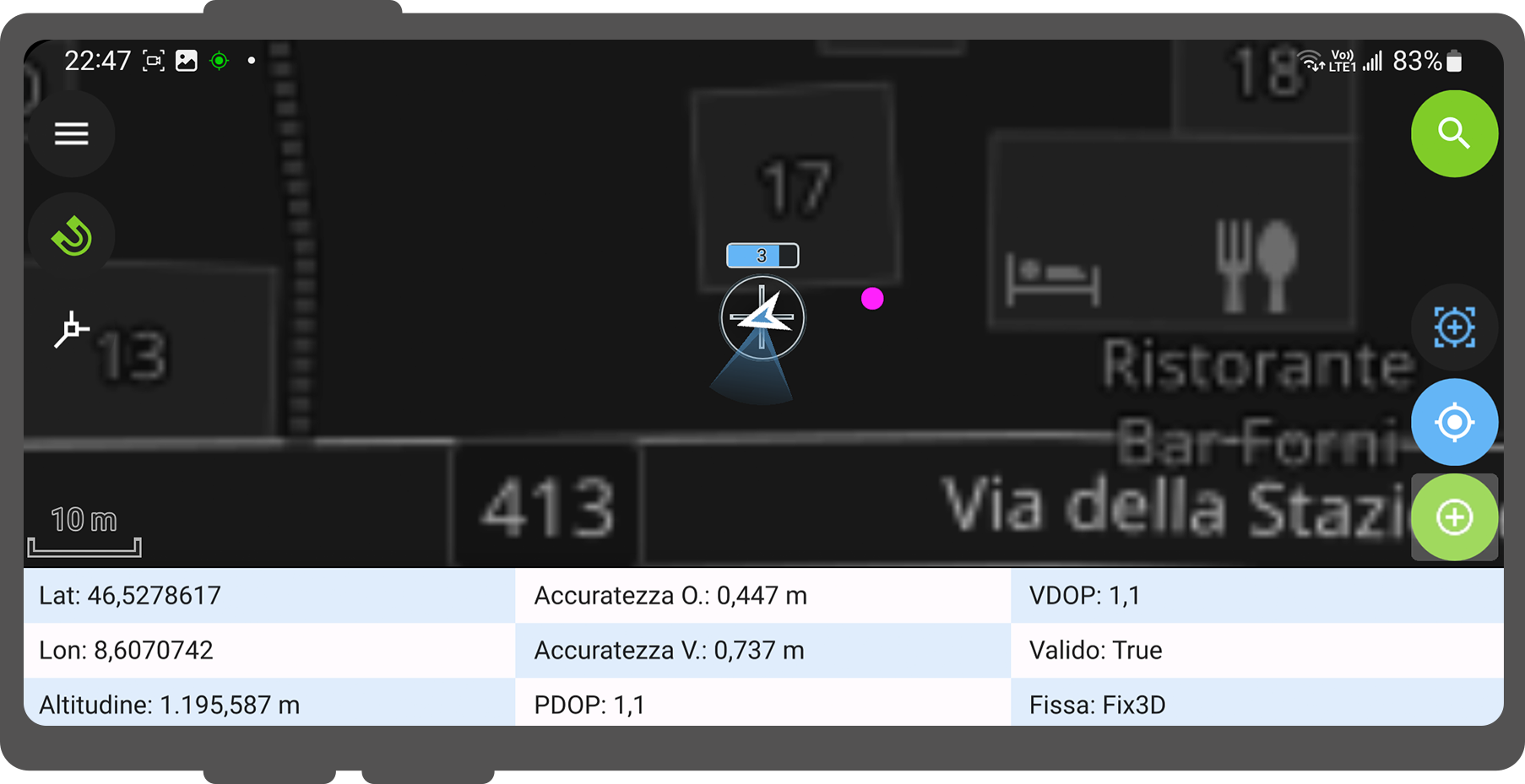
GPS, TRACKING AND NAVIGATION
Subcentimeter positioning
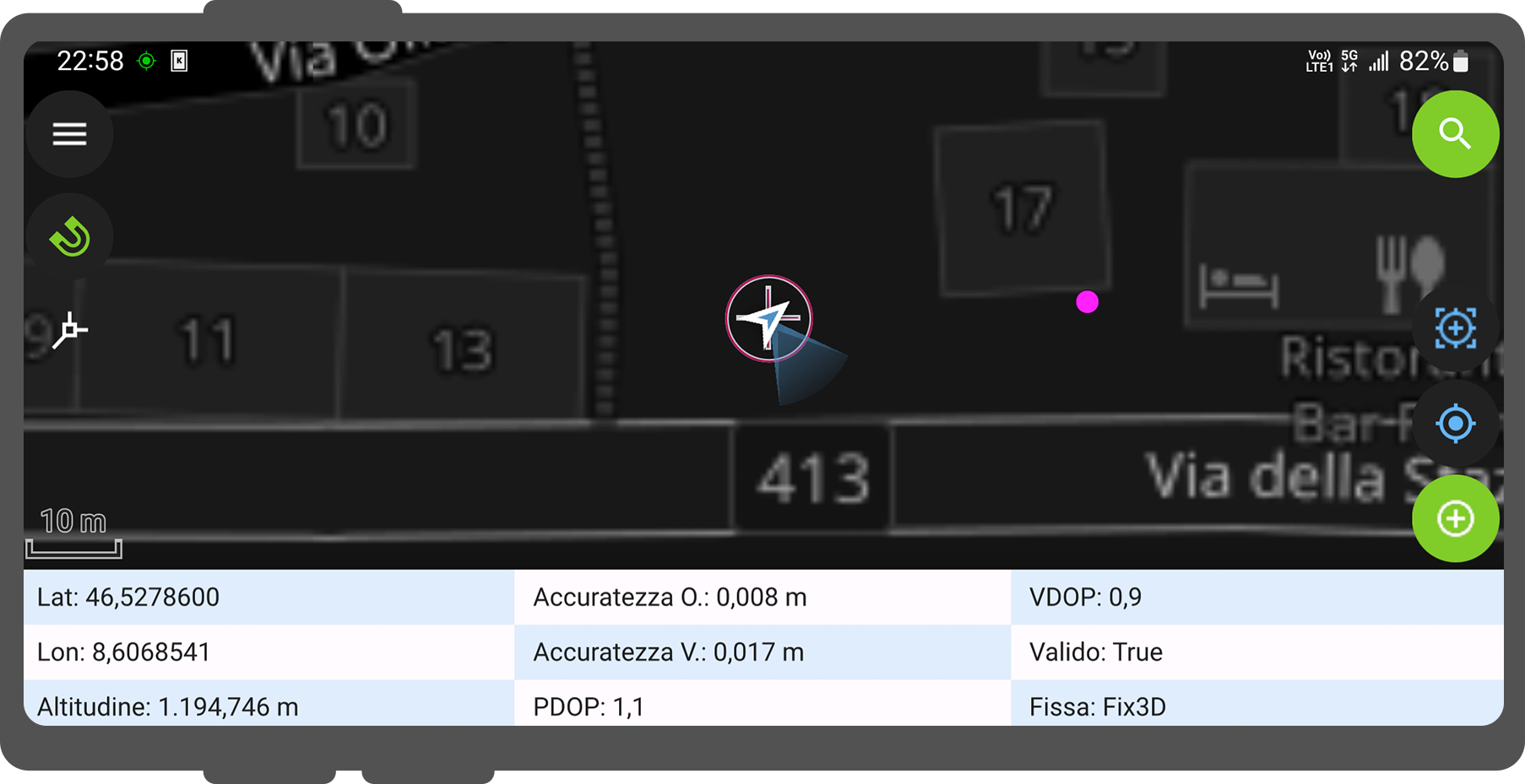
GPS, TRACKING AND NAVIGATION
Position averaging
GPS, TRACKING AND NAVIGATION
IMU Professional game changer

GPS, TRACKING AND NAVIGATION
Tracking
GPS, TRACKING AND NAVIGATION
Set feature as destination

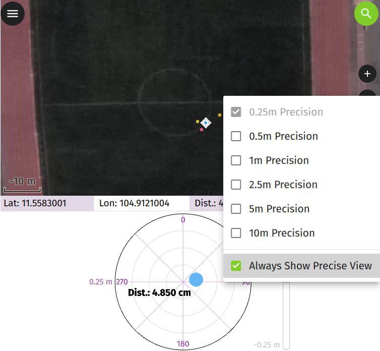
GPS, TRACKING AND NAVIGATION
Stakeout with precise view
EXTERNAL
SENSORS
EXTERNAL SENSORS
Example geiger sensor
EXTERNAL SENSORS
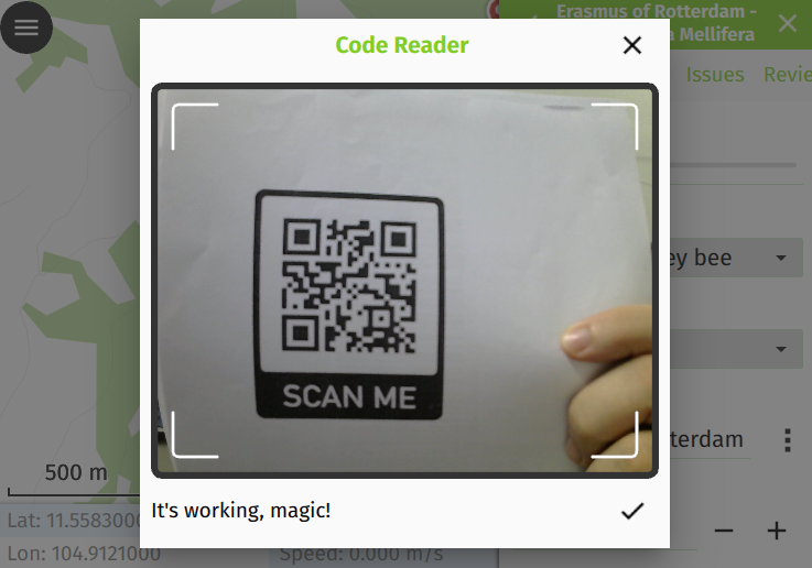
QR Code and NFC Reader
OTHER
FEATURES
OTHER FEATURES
Atlas printing
OTHER FEATURES
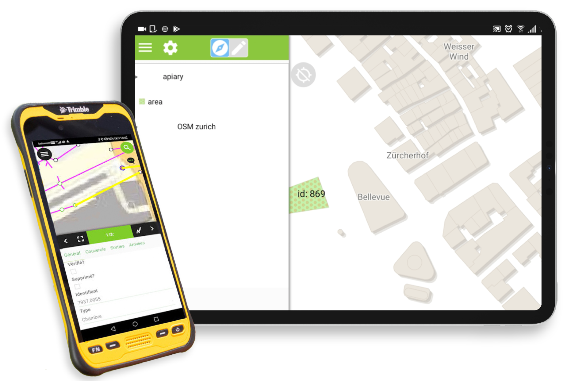
Opening individual datasets
OTHER FEATURES
Height profile
OTHER FEATURES
Searching for attributes and coordinates
OTHER FEATURES
Measurement tool
OTHER FEATURES
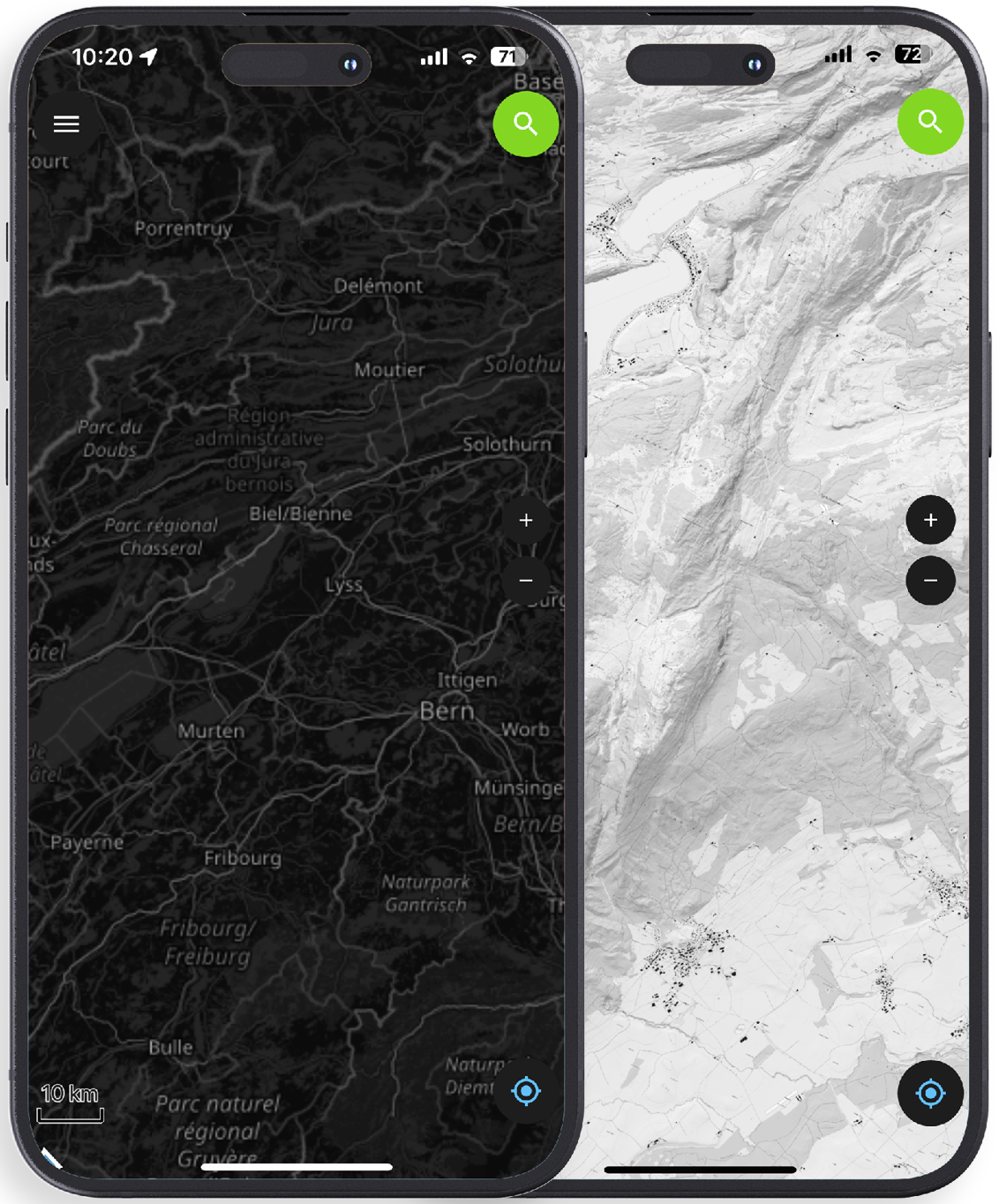
Dark mode
OTHER FEATURES
And much more…
- Geometry editing and drawing
- Dashboard widgets (QML/HTML)
- Time filter
- Rotation
OTHER FEATURES
Dashboard widgets (QML/HTML)
OTHER FEATURES
Time filter
OTHER FEATURES
Rotation
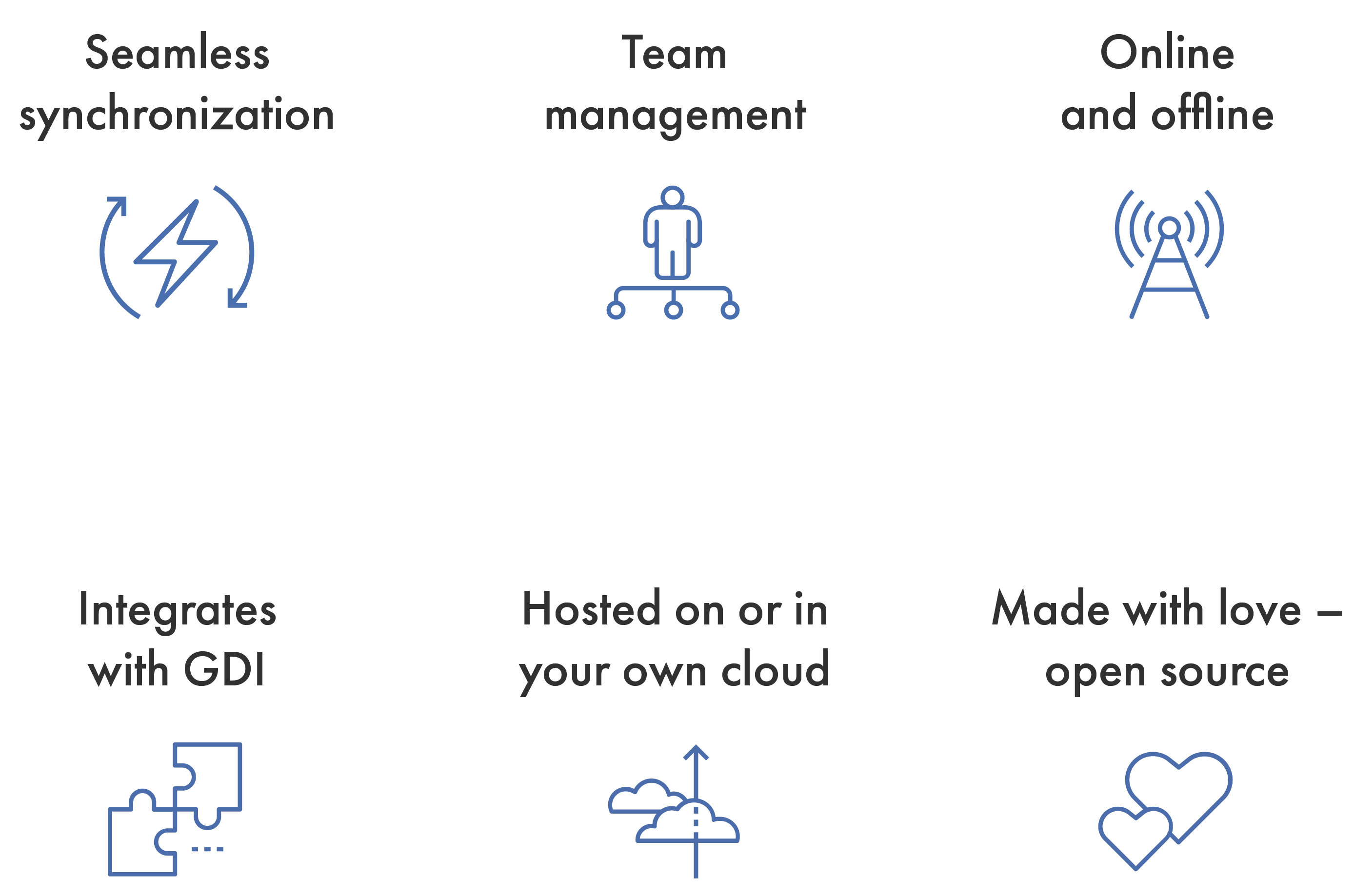
QFIELDCLOUD
Seamless fieldwork.
Seamless synchronization.

QFIELDCLOUD
QFIELD 3.0
BE PART OF YOUR
OWN APP
THANKS!
QUESTIONS?
- qfield.org | qfield.cloud
- @opengisch
- info@opengis.ch